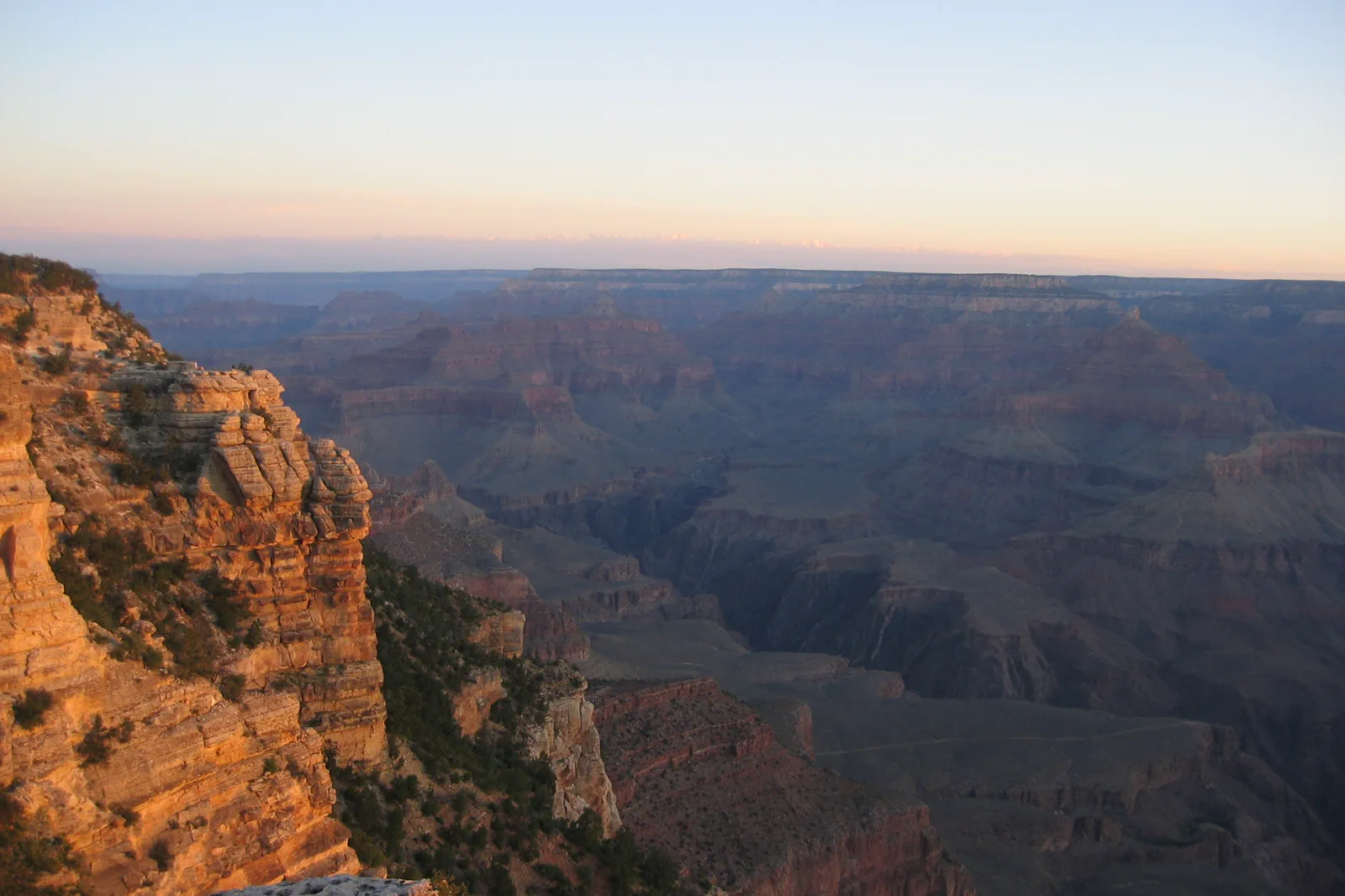
Grand Canyon South Rim / A view with time to understand it
Stay on the rim.
Look into deep time.
Mather Point, Yavapai and a selected rim section can make a complete first visit. Going below the rim is a separate hike, not the test of whether you really saw the canyon.
South Rim, North Rim and Grand Canyon West are different trips
Use the NPS South Rim destination for this guide. A booking near the North Rim or at Grand Canyon West will not put you beside the same visitor center and rim paths. Check the exact accommodation, entrance and attraction before comparing prices or travel time.
NPS: Grand Canyon visit planning
Grand Canyon West is the Hualapai destination associated with the Skywalk and its own admission system. The North Rim has a separate road approach and its own current service limitations. Neither should be used as a casual substitute when a South Rim booking or parking plan does not work.
Grand Canyon West: Hualapai destination and its own visitor arrangements
Mather Point → Yavapai → a selected Trail of Time portion
Visitor information and Mather Point
Begin with the current park information and use the designated public approach to the viewpoint. Let the first view establish the canyon’s scale rather than immediately leaving to find a supposedly better photograph. Keep everyone behind the relevant barriers and within public space.
Yavapai Geology Museum area
Choose the current walking or shuttle connection to Yavapai. Use the interpretation to relate the visible layers to the landscape, giving the visit more substance than a sequence of overlooks. Confirm the building’s actual availability if entering is important.
Trail of Time · Select a manageable portion
NPS describes this interpretive route along the paved Rim Trail west of Yavapai. Use the rock samples and timeline to read the canyon at another scale. Choose the portion and return that fit the group rather than treating the whole length as compulsory.
Village or a return to the starting area
Continue toward the village only when the route and energy support it; otherwise use an appropriate return. Arrange the meal around the place where the visit actually ends instead of repeatedly moving between the same stops.
NPS: Trail of Time and the Yavapai connection
This is an editorial sequence, not a surveyed accessible route or an official guided-tour duration. Confirm the exact path and current conditions for your needs. A shorter Mather-and-Yavapai visit can be complete when a longer rim walk would make the return uncomfortable.
Blue, Orange, Red and Tusayan do not serve the same purpose
Village / Blue route
Use the current map for connections between visitor services, accommodation areas and the main visitor-center hub. A bus stop can still require a walk to the actual canyon view.
Kaibab Rim / Orange route
Check the correct direction and stop for the viewpoint or trailhead you selected. The visitor-center connection toward Mather and Yavapai is different from the eastern branch toward South Kaibab and Yaki Point.
Hermits Rest / Red route
Treat this as an additional scenic-road portion with selected stops and a complete return. NPS lists private-vehicle restrictions on Hermit Road from March through November 2026; an early drive should not be assumed to bypass that rule.
Tusayan / Purple route
Read the actual season before using it to choose a hotel. NPS lists the 2026 Tusayan service ending September 11, not continuing through the whole autumn. A later trip needs another confirmed entrance arrangement.
NPS: South Rim shuttle routes and 2026 seasonal changes
Select one additional shuttle portion rather than treating every route as a tour that must be ridden. The final useful service for the group is more important than the last possible photograph. Check current schedules close to travel because seasonal changes can happen within the same month.
Below-rim hiking is not an extension of a viewpoint pause
A descent involves a climb back and conditions that can differ greatly from the rim. Use the exact NPS trail and current-closure guidance if a hike is the main purpose. This introductory plan does not propose a river descent, a rim-to-rim route or a casual addition below the rim after a full sightseeing day.
NPS: rim and below-rim hiking distinctions
Keep drinking water, food, appropriate clothing and the return organized before the visit. A visitor facility’s presence on the map does not guarantee every service at every hour. If conditions or access change, shorten the selected rim portion or use a currently available interpretation stop rather than chasing an unfamiliar route.
An overnight can make time for a second look in different light, but visibility and weather are not guaranteed by the booking. The geological interpretation and the changing perspective along a modest rim section can provide the value of the visit without requiring a specific sky or an ambitious hike.
Finish with enough time for the full return to the accommodation. If the day also includes moving to Sedona, Flagstaff or another base, reduce optional stops before the road journey becomes the least considered part of the plan.
Before moving to another landscape
Do I need to descend into the canyon for a meaningful visit?
No. A rim visit with geological interpretation and a selected walk can be complete. A below-rim hike is a different undertaking that requires its own current guidance and preparation.
Does the Tusayan shuttle run throughout autumn 2026?
The published 2026 season ends September 11. Recheck current service for the actual date and do not choose a hotel on the assumption that the summer bus continues indefinitely.
Choose another Arizona landscape
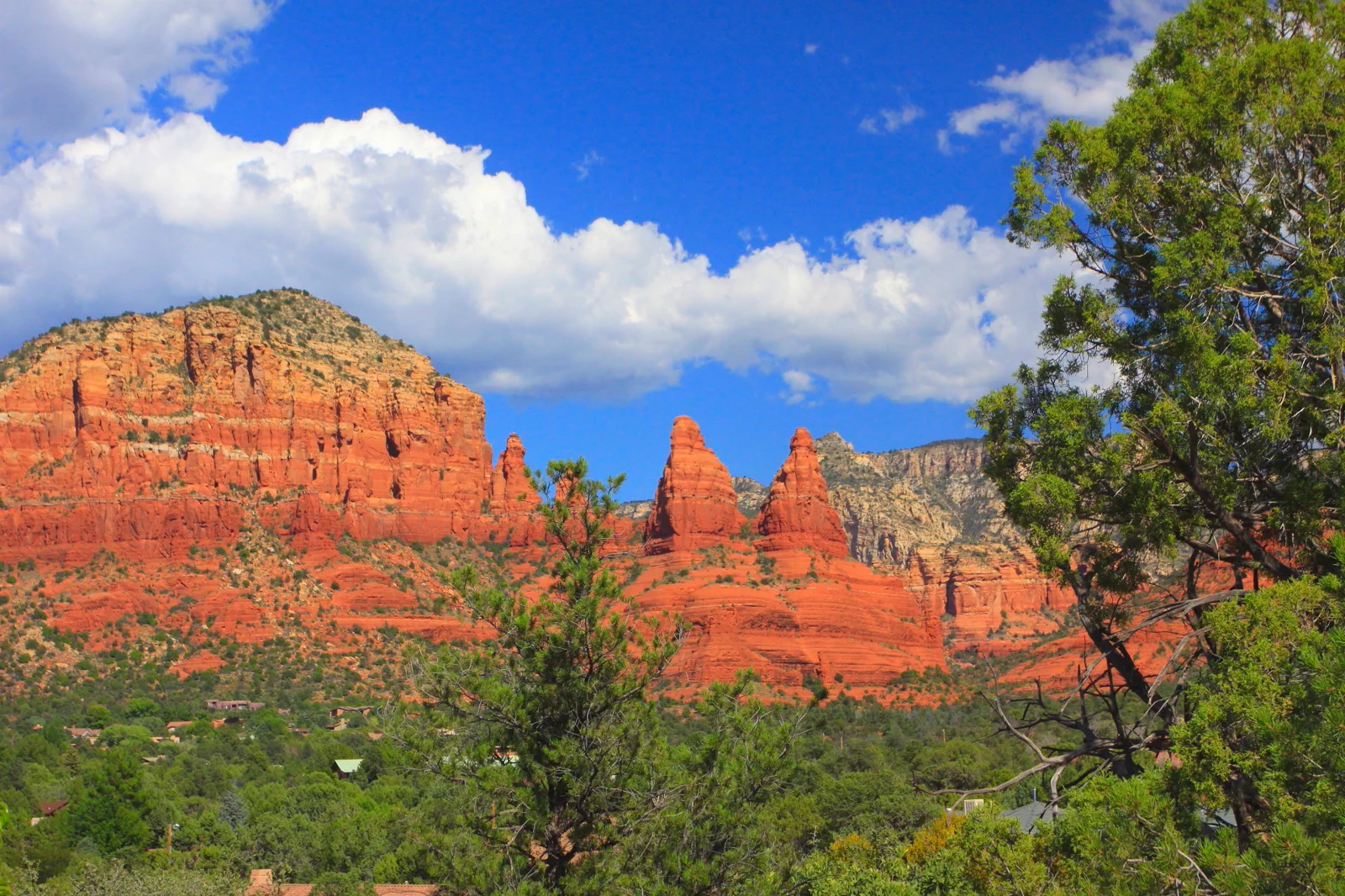
Sedona & Red Rock Trails
Sedona combines a town visit with red-rock trails whose parking and heat conditions need planning. Choose a route for its grade and access rather than following a social-media location that may be crowded or restricted.
Open guide →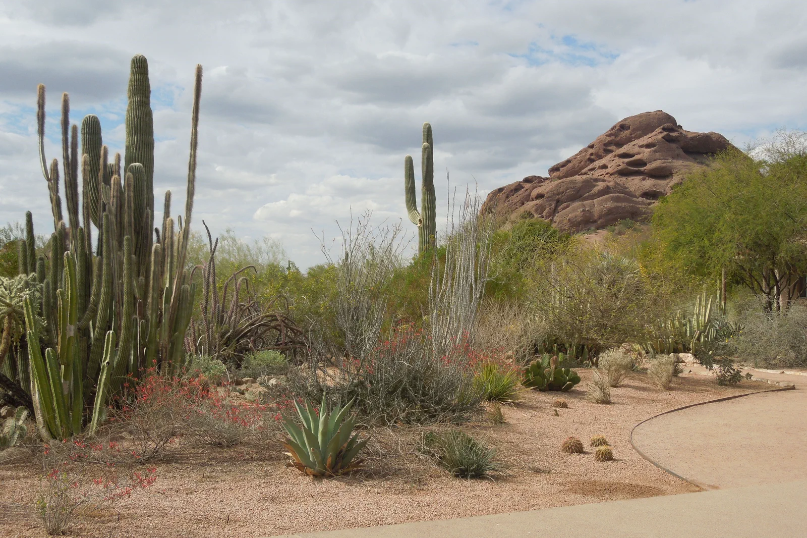
Phoenix & Scottsdale
The Phoenix area is a broad desert metropolis with museums, gardens and severe seasonal heat. A cultural day can be rewarding without a summit hike, especially when temperatures make exposed trails inappropriate.
Open guide →References, review and image credits
Source information checked on 11 September 2026. Route order, comparisons and suggested pacing are TripDistill editorial judgments; they are not official operator itineraries.
- NPS: Grand Canyon visit planning
- Grand Canyon West: Hualapai destination and its own visitor arrangements
- NPS: North Rim status and limited services
- NPS: Trail of Time and the Yavapai connection
- NPS: South Rim shuttle routes and 2026 seasonal changes
- NPS: rim and below-rim hiking distinctions
- Grand Canyon South Rim — “Jon Zander ( Digon3 )”, CC BY-SA 3.0. Resized, display-cropped and converted to WebP; no other material edits.
- Sedona & Red Rock Trails — Ernst Krenger, CC BY 3.0. Resized, display-cropped and converted to WebP; no other material edits.
- Phoenix & Scottsdale — Simeon87, CC BY-SA 3.0. Resized, display-cropped and converted to WebP; no other material edits.
Editorial review: 11 September 2026. Check current official information before travel.